This was a big day. We left West Otterpaw lake by 8 am wanting to beat the heat. We were starting the third loop of the trail today and passed the old cut off which has been closed for years. The further you go on this trail, the worse the condition becomes. Some trail maintenance is long overdue.
George, one of my regular hiking companions is from Waubushene, Ontario. George went thigh deep in loon crap stepping off one old log crossing in an area desperate for trail maintenance. I fared better only going ankle deep before catching myself. The trail markers, red in this section, are old, faded, cracked, and many are missing. It is clearly less well marked going counter clockwise.
We did get to see a moose early on. She was standing on the trail when we approached, just having come up from the shore of a lake. She stayed a good ten minutes curiously getting closer on the trail when Rob, one of my other hiking companions did a male moose call. Eventually she cut back to the shore and let us pass.
Only when we passed the Rain Lake turn off at the northern end of the loop did we see other people camping along Islet Lake. There are lots of well established lake front sites on Islet Lake. We just hoped our site on Weed Lake would be similar. The site turned out to be big enough for our four tents but the water access was as the name lake name described. We set up by 2 pm having walked 19 km.
George’s wife sent us a weather alert via his satellite messager warning of a monumental weather event – 40 mm of rain, wind, possible tornadoes, and more of the same for two days. Last year we hiked a portion of the Long Trail in Vermont and got caught in the storm of the century, flooding many communities and turning the trail into a rushing creek. We didn’t want to relive that experience so we weighed our options. Continuing our route south ahead of schedule didn’t offer any early escape. We didn’t want to inconvenience anyone by changing our stops and staying on someone else’s site. I suggested we could exit via Rain Lake to the north if we could get someone to pick us up. George put out the request via satellite and my wife Kelly responded. She would pick us up at Rain Lake at 9 pm.
We ate supper quickly and took down camp. By 5 pm we were walking north. We stopped to warn the Boy Scouts we knew were camped close by.

Their leader, Rob, was from Barry’s Bay as were the scouts with him. They were going to tough it out as they didn’t have any other option. I learned on Instagram later that they had a great adventure with lots of rain and washed out trails, but finished as scheduled.
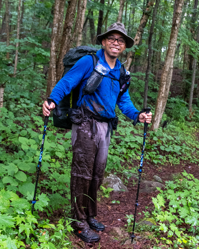
Mark, my hiking companion repacked and ready to hike another 24 km after we decided to avoid the forecasted weather bomb heading for us. All told, we would hike 43 km this day.
Once we reached the old rail bed that is the northern access to the trail I assumed easy travel. The rails are gone and the ties were left to rot away. Some have rotted but many remain. A fair bit of the trail was an easy sandy walk but wherever the rail bed was cut through a hill with sides sloping up from the bed, the water pooled and couldn’t escape. Railroad tie hopping and side hugging is necessary to stay semi-dry. Travel was slow. The trail out was an additional 15 km, making it a 43 km day, much more than any of us bargained for.

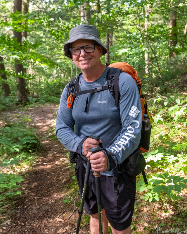
Rob, my hiking companion from Midland had been favouring his knee since day one and was wearing my knee brace. By km 28, he was in pain; by km 43, he was exhausted.
Mark, George, and I finished 15 minutes ahead of Rob, at 8 pm. The bugs were thick and I put on my bug net for the first time. Just as Rob crossed the final bridge to the Rain Lake access point, my wife Kelly drove in. Perfect timing.
We were home by 11:30 pm. Mark and Rob drove back the next morning to get pick up Mark’s car from the Western Uplands Trail parking lot. Our trip didn’t finish as expected but once again we have a good story to tell.